Haiwarde's Map
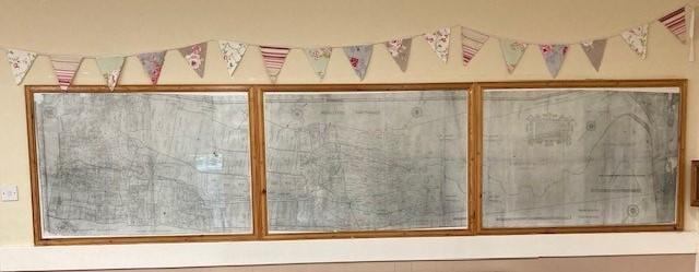
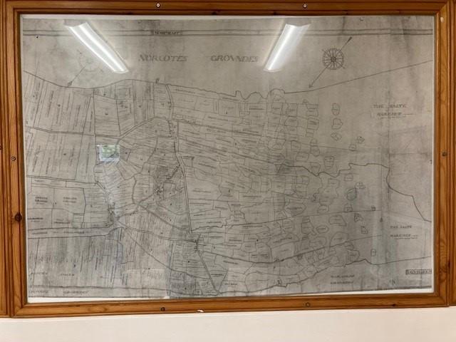
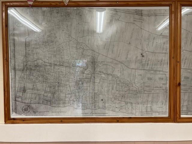
Photographic representations of this spectacular map can be seen in the bar area of the Village Hall. With careful scrutiny you can pick out features of Marshchapel that are still there today. It’s a fascinating site dating back to life in the 1590’s, over 400 years ago.
The original map was lent to the Parish Council in the early 1990’s and with the owner’s permission, was taken to Cambridge University to be photographed. The Parish Council had the only reprinted copy of the map framed for display in the Village Hall. Two sets of negatives were made by the University, the Parish Council retains one set and the other set is in the ownership of the Burgess family in Marshchapel.
We were so pleased to be able to get the map photographed as it was not in a great state of repair and despite our efforts to get it admitted to Lincolnshire Archives the current owner wishes to retain it in his care.
We are extremely privileged to have our copy and a set of negatives.
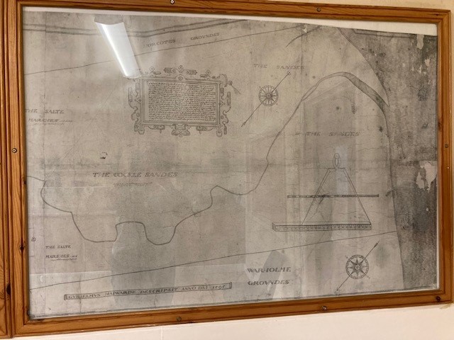
William Haiwarde, who made this map in 1595, describes his own work in a panel on the right hand side. It translates as follows:
“The description and Platte of the towns of ffulstowe and Marshchappell with all the particular groundes set down in theire true shape and proportion. The cheif Lordes are the L. Willughbie of Ears bye for the Manor of Westhall and Sir Christofor Hilyarde for the Manor of Northall.
The whole demesne of bothe the saide manors are let out by lease to divers tenaunts and no partes thereof holden by Copie of Court Roll.
The L Willughbies groundes are distinguished by two colours, the meadow groundes beinge all greene and the other groundes both feild and pasture of a straw colour or pale yellow.
Sir Christopfor Hilyardes groundes are of bright yellow or saffron colour.
Mr Allington’s groundes (which were sometime belonging to the Abbye of Louth Parke) are of a roset or peach colour and the glebe lande of the Rectories which are impropriations of the said L Willughbie are of an ashie or waterie colour. The other ffreeholders are left uncoloured. The redd lines are the boundes of the several furlongs so much being accounted to be of that furlong as is contained within that redde line. The figures of every furlonge serve for the readie findinge out of those groundes in the feilde book as in the beginning of the saide book more plainlie appeareth.
The round groundes at the Easte end of Marshchappell are called maures and are firste framed by laying together of great quantities of moulde for the making of Salte.
When the maures grow greate the Salt makers remove more easte and come nearer to the Sea and then the former maures become in some fewe years good pasture groundes.
Those that have the Cotages nowe upon them are at this presente in use for salt. The Breadth and length of every pece and all distances of places within this plat are to be knowen by the scale of pertches here set downe.”
Maps of this age and containing so much detail are very rare and we are extremely fortunate that the original, from which these photographic copies have been taken, has survived and remained in local ownership, albeit the colours have virtually disappeared.
It is drawn to a scale of 16 inches to the mile and is eleven feet long and thirty four inches wide.
The present owner’s father purchased the map, at an auction in 1933, at Brigg, for the princely sum of £2.7s 6d (£2.37½). It had been in the possession of Mr Alfred Atkinson, a civil engineer at Brigg, for many years.
Where the map had been for the previous 300 years is not known but it is obviously an estate map and as such would have been originally made for one of the two major land owners, Lord Willoughby or Sir Christopher Hilyard.
The field book mentioned in Haiwarde’s description is now in the Lincolnshire Archives and whereas the map gives the names of the owners of each strip of land, the field book gives the names of the individual tenants, the names of the people who were actually living on and working the land.
William Haiwarde himself was probably born in Walsingham, Norfolk, circa 1560 and was admitted to Cambridge University in 1578. He was an Elizabethan map-maker of some note.